Lantenay | |
|---|---|
Commune | |
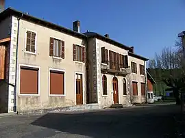 Town hall | |
Location of Lantenay | |
 Lantenay  Lantenay | |
| Coordinates: 46°03′30″N 5°32′32″E / 46.0583°N 5.5422°E | |
| Country | France |
| Region | Auvergne-Rhône-Alpes |
| Department | Ain |
| Arrondissement | Nantua |
| Canton | Plateau d'Hauteville |
| Intercommunality | Haut-Bugey Agglomération |
| Government | |
| • Mayor (2020–2026) | Jean-Louis Benoit[1] |
| Area 1 | 6.59 km2 (2.54 sq mi) |
| Population | 270 |
| • Density | 41/km2 (110/sq mi) |
| Time zone | UTC+01:00 (CET) |
| • Summer (DST) | UTC+02:00 (CEST) |
| INSEE/Postal code | 01206 /01430 |
| Elevation | 650–1,012 m (2,133–3,320 ft) (avg. 730 m or 2,400 ft) |
| 1 French Land Register data, which excludes lakes, ponds, glaciers > 1 km2 (0.386 sq mi or 247 acres) and river estuaries. | |
Lantenay (French pronunciation: [lɑ̃tnɛ] ⓘ) is a commune in the Ain department in eastern France.
Population
| Year | Pop. | ±% p.a. |
|---|---|---|
| 1968 | 186 | — |
| 1975 | 176 | −0.79% |
| 1982 | 198 | +1.70% |
| 1990 | 235 | +2.16% |
| 1999 | 260 | +1.13% |
| 2009 | 254 | −0.23% |
| 2014 | 262 | +0.62% |
| 2020 | 274 | +0.75% |
| Source: INSEE[3] | ||
See also
References
- ↑ "Répertoire national des élus: les maires". data.gouv.fr, Plateforme ouverte des données publiques françaises (in French). 2 December 2020.
- ↑ "Populations légales 2021". The National Institute of Statistics and Economic Studies. 28 December 2023.
- ↑ Population en historique depuis 1968, INSEE
Wikimedia Commons has media related to Lantenay, Ain.
This article is issued from Wikipedia. The text is licensed under Creative Commons - Attribution - Sharealike. Additional terms may apply for the media files.