Herzogenburg | |
|---|---|
.JPG.webp) Herzogenburg seen from west | |
 Coat of arms | |
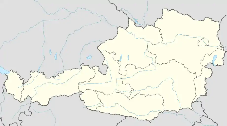 Herzogenburg Location within Austria | |
| Coordinates: 48°17′N 15°41′E / 48.283°N 15.683°E | |
| Country | Austria |
| State | Lower Austria |
| District | Sankt Pölten-Land |
| Government | |
| • Mayor | Christoph Artner |
| Area | |
| • Total | 46.09 km2 (17.80 sq mi) |
| Elevation | 229 m (751 ft) |
| Population (2018-01-01)[2] | |
| • Total | 7,771 |
| • Density | 170/km2 (440/sq mi) |
| Time zone | UTC+1 (CET) |
| • Summer (DST) | UTC+2 (CEST) |
| Postal code | 3130 |
| Area code | +43 2782 |
| Website | http://www.herzogenburg.at |
Herzogenburg is a town in the district of Sankt Pölten-Land in the Austrian state of Lower Austria.
Population
| Year | Pop. | ±% |
|---|---|---|
| 1869 | 4,322 | — |
| 1880 | 4,500 | +4.1% |
| 1890 | 4,768 | +6.0% |
| 1900 | 5,396 | +13.2% |
| 1910 | 6,398 | +18.6% |
| 1923 | 5,935 | −7.2% |
| 1934 | 6,371 | +7.3% |
| 1939 | 6,226 | −2.3% |
| 1951 | 6,437 | +3.4% |
| 1961 | 6,805 | +5.7% |
| 1971 | 7,423 | +9.1% |
| 1981 | 7,299 | −1.7% |
| 1991 | 7,461 | +2.2% |
| 2001 | 7,738 | +3.7% |
| 2011 | 7,828 | +1.2% |
| 2016 | 7,738 | −1.1% |
References
- ↑ "Dauersiedlungsraum der Gemeinden Politischen Bezirke und Bundesländer - Gebietsstand 1.1.2018". Statistics Austria. Retrieved 10 March 2019.
- ↑ "Einwohnerzahl 1.1.2018 nach Gemeinden mit Status, Gebietsstand 1.1.2018". Statistics Austria. Retrieved 9 March 2019.
This article is issued from Wikipedia. The text is licensed under Creative Commons - Attribution - Sharealike. Additional terms may apply for the media files.