Greenwood, Pennsylvania | |
|---|---|
 Greenwood | |
| Coordinates: 40°31′57″N 78°21′32″W / 40.53250°N 78.35889°W | |
| Country | United States |
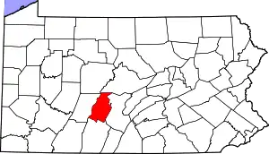
| State | Pennsylvania |
| County | Blair |
| Township | Logan |
| Area | |
| • Total | 1.64 sq mi (4.25 km2) |
| • Land | 1.64 sq mi (4.25 km2) |
| • Water | 0.00 sq mi (0.00 km2) |
| Elevation | 1,224 ft (373 m) |
| Population | |
| • Total | 3,114 |
| • Density | 1,898.78/sq mi (733.06/km2) |
| Time zone | UTC-5 (Eastern (EST)) |
| • Summer (DST) | UTC-4 (EDT) |
| FIPS code | 42-31368 |
| GNIS feature ID | 2630602 |
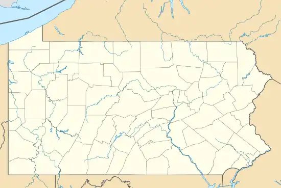
Greenwood is a census-designated place[3] in Logan Township, Blair County, Pennsylvania, United States. It is located near I-99 and is adjacent in the northeast to the city of Altoona. As of the 2010 census, the population was 2,458 residents.[4] It is often considered a district of Altoona, as the addresses are listed as Altoona addresses and some of the avenues use Altoona's numbering system.
Demographics
| Census | Pop. | Note | %± |
|---|---|---|---|
| 2020 | 3,114 | — | |
| U.S. Decennial Census[5] | |||
References
- ↑ "ArcGIS REST Services Directory". United States Census Bureau. Retrieved October 12, 2022.
- ↑ "Census Population API". United States Census Bureau. Retrieved October 12, 2022.
- ↑ "2010 U.S. Census website". United States Census Bureau. Retrieved February 10, 2013.
- ↑ "U.S. Census website". United States Census Bureau. Retrieved May 14, 2011.
- ↑ "Census of Population and Housing". Census.gov. Retrieved June 4, 2016.
External links
This article is issued from Wikipedia. The text is licensed under Creative Commons - Attribution - Sharealike. Additional terms may apply for the media files.