White Rock Township | |
|---|---|
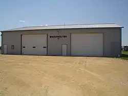 White Rock Township building located in Kings. | |
 | |
.svg.png.webp) Location of Illinois in the United States | |
| Coordinates: 42°00′49″N 89°06′34″W / 42.01361°N 89.10944°W | |
| Country | United States |
| State | Illinois |
| County | Ogle |
| Organized | November 6, 1849 |
| Government | |
| • Mayor | John Greenfield |
| Area | |
| • Total | 35.56 sq mi (92.1 km2) |
| • Land | 35.54 sq mi (92.0 km2) |
| • Water | 0.03 sq mi (0.08 km2) |
| Elevation | 574 ft (175 m) |
| Population (2010) | |
| • Estimate (2016)[1] | 710 |
| • Density | 20.8/sq mi (8.0/km2) |
| Time zone | UTC-6 (CST) |
| • Summer (DST) | UTC-5 (CDT) |
| FIPS code | 17-141-81399 |
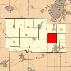
White Rock Township is located in Ogle County, Illinois, United States. As of the 2010 census, its population was 738 and it contained 298 housing units.[2]
Geography
The unincorporated community of White Rock is located in the township.
According to the 2010 census, the township has a total area of 35.56 square miles (92.1 km2), of which 35.54 square miles (92.0 km2) (or 99.94%) is land and 0.03 square miles (0.078 km2) (or 0.08%) is water.[2]
Demographics
| Census | Pop. | Note | %± |
|---|---|---|---|
| 2016 (est.) | 710 | [1] | |
| U.S. Decennial Census[3] | |||
References
- 1 2 "Population and Housing Unit Estimates". Retrieved June 9, 2017.
- 1 2 "Population, Housing Units, Area, and Density: 2010 - County -- County Subdivision and Place -- 2010 Census Summary File 1". United States Census. Archived from the original on February 12, 2020. Retrieved May 28, 2013.
- ↑ "Census of Population and Housing". Census.gov. Retrieved June 4, 2016.
External links
Municipalities and communities of Ogle County, Illinois, United States | ||
|---|---|---|
| Cities | Map of Illinois highlighting Ogle County | |
| Villages | ||
| Townships | ||
| CDPs | ||
| Other communities | ||
| Footnotes | ‡This populated place also has portions in an adjacent county or counties | |
This article is issued from Wikipedia. The text is licensed under Creative Commons - Attribution - Sharealike. Additional terms may apply for the media files.