Tourville-sur-Pont-Audemer | |
|---|---|
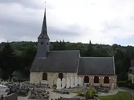 The church in Tourville-sur-Pont-Audemer | |
Location of Tourville-sur-Pont-Audemer | |
 Tourville-sur-Pont-Audemer 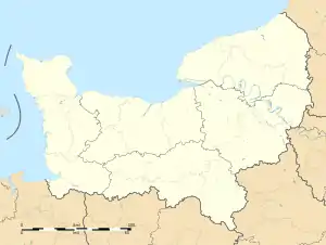 Tourville-sur-Pont-Audemer | |
| Coordinates: 49°19′56″N 0°30′33″E / 49.3322°N 0.5092°E | |
| Country | France |
| Region | Normandy |
| Department | Eure |
| Arrondissement | Bernay |
| Canton | Pont-Audemer |
| Intercommunality | Pont-Audemer / Val de Risle |
| Government | |
| • Mayor (2020–2026) | Jean Legrix[1] |
| Area 1 | 10.8 km2 (4.2 sq mi) |
| Population | 725 |
| • Density | 67/km2 (170/sq mi) |
| Time zone | UTC+01:00 (CET) |
| • Summer (DST) | UTC+02:00 (CEST) |
| INSEE/Postal code | 27655 /27500 |
| Elevation | 11–127 m (36–417 ft) (avg. 105 m or 344 ft) |
| 1 French Land Register data, which excludes lakes, ponds, glaciers > 1 km2 (0.386 sq mi or 247 acres) and river estuaries. | |
Tourville-sur-Pont-Audemer (French pronunciation: [tuʁvil syʁ pɔ̃.t‿odmɛʁ], literally Tourville on Pont-Audemer) is a commune in the Eure department in Normandy in northern France. Its name is derived from its founder Torf.
Population
| Year | Pop. | ±% p.a. |
|---|---|---|
| 1968 | 506 | — |
| 1975 | 565 | +1.59% |
| 1982 | 507 | −1.54% |
| 1990 | 528 | +0.51% |
| 1999 | 554 | +0.54% |
| 2009 | 716 | +2.60% |
| 2014 | 732 | +0.44% |
| 2020 | 731 | −0.02% |
| Source: INSEE[3] | ||
See also
References
- ↑ "Répertoire national des élus: les maires". data.gouv.fr, Plateforme ouverte des données publiques françaises (in French). 2 December 2020.
- ↑ "Populations légales 2021". The National Institute of Statistics and Economic Studies. 28 December 2023.
- ↑ Population en historique depuis 1968, INSEE
Wikimedia Commons has media related to Tourville-sur-Pont-Audemer.
This article is issued from Wikipedia. The text is licensed under Creative Commons - Attribution - Sharealike. Additional terms may apply for the media files.