Terre du Lac, Missouri | |
|---|---|
| Country | United States |
| State | Missouri |
| County | St. Francois County |
| Area | |
| • Total | 7.56 sq mi (19.58 km2) |
| • Land | 6.99 sq mi (18.10 km2) |
| • Water | 0.57 sq mi (1.49 km2) |
| Elevation | 905 ft (276 m) |
| Population (2020) | |
| • Total | 2,478 |
| • Density | 354.66/sq mi (136.94/km2) |
| FIPS code | 29-72772 |
| GNIS feature ID | 2587116[2] |
Terre du Lac is an unincorporated community and census-designated place in St. Francois and Washington counties in the U.S. state of Missouri.[2][3] It uses zip code 63628, from neighboring Bonne Terre.
The recreational community is built around several man-made lakes and a golf course overlooking the Big River valley to the south.[3]
Demographics
| Census | Pop. | Note | %± |
|---|---|---|---|
| 2020 | 2,478 | — | |
| U.S. Decennial Census[4] | |||
References
- ↑ "ArcGIS REST Services Directory". United States Census Bureau. Retrieved September 5, 2022.
- 1 2 3 U.S. Geological Survey Geographic Names Information System: Terre du Lac, Missouri
- 1 2 Bonne Terre, Missouri and Mineral Point, Missouri, 7.5 Minute Topographic Quadrangles, USGS, 1958 (revised 1982)
- ↑ "Census of Population and Housing". Census.gov. Retrieved June 4, 2016.
External links
Municipalities and communities of Saint Francois County, Missouri, United States | ||
|---|---|---|
| Cities | 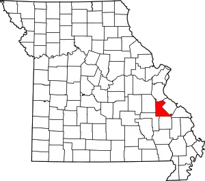 Map of Missouri highlighting Saint Francois County | |
| Townships | ||
| CDPs | ||
| Other communities | ||
| Ghost towns | ||
| Footnotes | ‡This populated place also has portions in an adjacent county or counties | |
37°54′11″N 90°36′57″W / 37.90306°N 90.61583°W
This article is issued from Wikipedia. The text is licensed under Creative Commons - Attribution - Sharealike. Additional terms may apply for the media files.