Smithfield Township | |
|---|---|
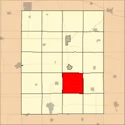 Location in Fayette County | |
| Coordinates: 42°46′52″N 91°46′49″W / 42.78111°N 91.78028°W | |
| Country | |
| State | |
| County | Fayette |
| Area | |
| • Total | 36.09 sq mi (93.47 km2) |
| • Land | 36.09 sq mi (93.47 km2) |
| • Water | 0 sq mi (0 km2) 0% |
| Elevation | 1,181 ft (360 m) |
| Population (2010) | |
| • Total | 250 |
| • Density | 6.9/sq mi (2.7/km2) |
| Time zone | UTC-6 (CST) |
| • Summer (DST) | UTC-5 (CDT) |
| ZIP codes | 50606, 52142 |
| GNIS feature ID | 0468723 |
Smithfield Township is one of twenty townships in Fayette County, Iowa, USA. As of the 2010 census, its population was 250.[1]
Geography
According to the United States Census Bureau, Smithfield Township covers an area of 36.09 square miles (93.47 square kilometers).
Adjacent townships
- Westfield Township (north)
- Illyria Township (northeast)
- Fairfield Township (east)
- Putnam Township (southeast)
- Scott Township (south)
- Jefferson Township (southwest)
- Harlan Township (west)
- Center Township (northwest)
Cemeteries
The township contains Garden Prairie Cemetery.
Major highways
School districts
- North Fayette Valley Community School District
- Starmont Community School District
- West Central Community School District
Political districts
- Iowa's 1st congressional district
- State House District 24
- State Senate District 12
References
External links
Municipalities and communities of Fayette County, Iowa, United States | ||
|---|---|---|
| Cities | Map of Iowa highlighting Fayette County | |
| Townships | ||
| Unincorporated communities | ||
| Footnotes | ‡This populated place also has portions in an adjacent county or counties | |
This article is issued from Wikipedia. The text is licensed under Creative Commons - Attribution - Sharealike. Additional terms may apply for the media files.