Saint-Raphaël | |
|---|---|
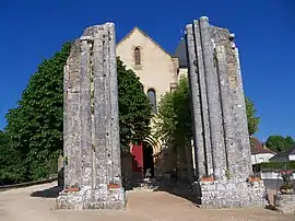 The church in Saint-Raphaël | |
Location of Saint-Raphaël | |
 Saint-Raphaël 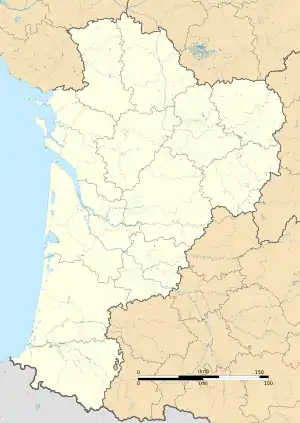 Saint-Raphaël | |
| Coordinates: 45°18′18″N 1°04′32″E / 45.305°N 1.0756°E | |
| Country | France |
| Region | Nouvelle-Aquitaine |
| Department | Dordogne |
| Arrondissement | Nontron |
| Canton | Isle-Loue-Auvézère |
| Government | |
| • Mayor (2020–2026) | François Philippe Clergerie[1] |
| Area 1 | 7.13 km2 (2.75 sq mi) |
| Population | 93 |
| • Density | 13/km2 (34/sq mi) |
| Time zone | UTC+01:00 (CET) |
| • Summer (DST) | UTC+02:00 (CEST) |
| INSEE/Postal code | 24493 /24160 |
| Elevation | 161–296 m (528–971 ft) (avg. 288 m or 945 ft) |
| 1 French Land Register data, which excludes lakes, ponds, glaciers > 1 km2 (0.386 sq mi or 247 acres) and river estuaries. | |
Saint-Raphaël (pronounced [sɛ̃ ʁafaɛl]; Occitan: Sent Rafeu) is a commune in the Dordogne department in Nouvelle-Aquitaine, France.
Population
| Year | Pop. | ±% |
|---|---|---|
| 1962 | 104 | — |
| 1968 | 112 | +7.7% |
| 1975 | 89 | −20.5% |
| 1982 | 93 | +4.5% |
| 1990 | 109 | +17.2% |
| 1999 | 93 | −14.7% |
| 2008 | 103 | +10.8% |
See also
References
- ↑ "Répertoire national des élus: les maires". data.gouv.fr, Plateforme ouverte des données publiques françaises (in French). 9 August 2021.
- ↑ "Populations légales 2021". The National Institute of Statistics and Economic Studies. 28 December 2023.
Wikimedia Commons has media related to Saint-Raphaël (Dordogne).
This article is issued from Wikipedia. The text is licensed under Creative Commons - Attribution - Sharealike. Additional terms may apply for the media files.