Saint-Malo-de-Beignon
Sant-Maloù-Benion | |
|---|---|
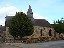 The Church of Saint-Malo, in Saint-Malo-de-Beignon | |
.svg.png.webp) Coat of arms | |
Location of Saint-Malo-de-Beignon | |
 Saint-Malo-de-Beignon  Saint-Malo-de-Beignon | |
| Coordinates: 47°57′34″N 2°08′54″W / 47.9594°N 2.1483°W | |
| Country | France |
| Region | Brittany |
| Department | Morbihan |
| Arrondissement | Vannes |
| Canton | Guer |
| Intercommunality | CC de l'Oust à Brocéliande |
| Government | |
| • Mayor (2020–2026) | Marie-Hélène Herry[1] |
| Area 1 | 3.49 km2 (1.35 sq mi) |
| Population | 543 |
| • Density | 160/km2 (400/sq mi) |
| Time zone | UTC+01:00 (CET) |
| • Summer (DST) | UTC+02:00 (CEST) |
| INSEE/Postal code | 56226 /56380 |
| Elevation | 50–153 m (164–502 ft) |
| 1 French Land Register data, which excludes lakes, ponds, glaciers > 1 km2 (0.386 sq mi or 247 acres) and river estuaries. | |
Saint-Malo-de-Beignon (French pronunciation: [sɛ̃ malo də bɛɲɔ̃], literally Saint-Malo of Beignon; Breton: Sant-Maloù-Benion) is a commune in the Morbihan department of Brittany in north-western France.[3] Inhabitants of Saint-Malo-de-Beignon are called in French Maloins.
See also
References
- ↑ "Maires du Morbihan" (PDF). Préfecture du Morbihan. 7 July 2020.
- ↑ "Populations légales 2021". The National Institute of Statistics and Economic Studies. 28 December 2023.
- ↑ INSEE commune file
External links
Wikimedia Commons has media related to Saint-Malo-de-Beignon.
- Base Mérimée: Search for heritage in the commune, Ministère français de la Culture. (in French)
- Mayors of Morbihan Association (in French)
This article is issued from Wikipedia. The text is licensed under Creative Commons - Attribution - Sharealike. Additional terms may apply for the media files.