Saint-Crépin-d'Auberoche | |
|---|---|
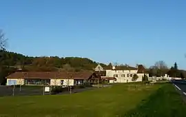 A general view of Saint-Crépin-d'Auberoche | |
Location of Saint-Crépin-d'Auberoche | |
 Saint-Crépin-d'Auberoche 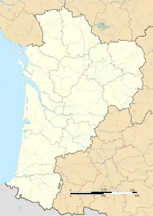 Saint-Crépin-d'Auberoche | |
| Coordinates: 45°07′28″N 0°53′26″E / 45.1244°N 0.8906°E | |
| Country | France |
| Region | Nouvelle-Aquitaine |
| Department | Dordogne |
| Arrondissement | Périgueux |
| Canton | Isle-Manoire |
| Intercommunality | Le Grand Périgueux |
| Government | |
| • Mayor (2020–2026) | Clovis Tallet[1] |
| Area 1 | 9.56 km2 (3.69 sq mi) |
| Population | 332 |
| • Density | 35/km2 (90/sq mi) |
| Time zone | UTC+01:00 (CET) |
| • Summer (DST) | UTC+02:00 (CEST) |
| INSEE/Postal code | 24390 /24330 |
| Elevation | 140–241 m (459–791 ft) (avg. 149 m or 489 ft) |
| 1 French Land Register data, which excludes lakes, ponds, glaciers > 1 km2 (0.386 sq mi or 247 acres) and river estuaries. | |
Saint-Crépin-d'Auberoche (French pronunciation: [sɛ̃ kʁepɛ̃ dobʁɔʃ]; Occitan: Sent Crespin d'Aubaròcha) is a commune in the Dordogne department in Nouvelle-Aquitaine in southwestern France.
Population
| Year | Pop. | ±% |
|---|---|---|
| 1962 | 246 | — |
| 1968 | 191 | −22.4% |
| 1975 | 175 | −8.4% |
| 1982 | 237 | +35.4% |
| 1990 | 229 | −3.4% |
| 1999 | 227 | −0.9% |
| 2008 | 282 | +24.2% |
See also
References
- ↑ "Répertoire national des élus: les maires". data.gouv.fr, Plateforme ouverte des données publiques françaises (in French). 2 December 2020.
- ↑ "Populations légales 2021". The National Institute of Statistics and Economic Studies. 28 December 2023.
Wikimedia Commons has media related to Saint-Crépin-d'Auberoche.
This article is issued from Wikipedia. The text is licensed under Creative Commons - Attribution - Sharealike. Additional terms may apply for the media files.