Les Bois | |||||||||||
|---|---|---|---|---|---|---|---|---|---|---|---|
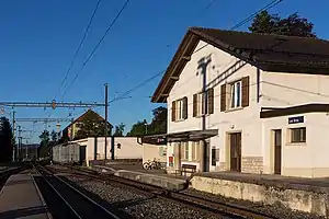 The station in 2016 | |||||||||||
| General information | |||||||||||
| Location | Les Bois, Jura Switzerland | ||||||||||
| Coordinates | 47°10′37″N 6°54′22″E / 47.17694°N 6.90611°E | ||||||||||
| Elevation | 1,028 m (3,373 ft) | ||||||||||
| Owned by | Chemins de fer du Jura | ||||||||||
| Line(s) | La Chaux-de-Fonds–Glovelier line | ||||||||||
| Distance | 30.2 km (18.8 mi) from Tavannes[1] | ||||||||||
| Platforms | 1 island platform | ||||||||||
| Tracks | 2 | ||||||||||
| Train operators | Chemins de fer du Jura | ||||||||||
| Other information | |||||||||||
| Fare zone | 42 (Onde Verte and Vagabond)[2][3] | ||||||||||
| Services | |||||||||||
| |||||||||||
| Location | |||||||||||
Les Bois railway station (French: Gare des Bois) is a railway station in the municipality of Les Bois, in the Swiss canton of Jura. It is located on the 1,000 mm (3 ft 3+3⁄8 in) La Chaux-de-Fonds–Glovelier line of the Chemins de fer du Jura.[1]
Services
As of the December 2020 timetable change, the following services stop at Les Bois:[4]
- Regio: hourly service between La Chaux-de-Fonds and Glovelier.
References
- 1 2 Eisenbahnatlas Schweiz. Cologne: Schweers + Wall. 2012. p. 17. ISBN 978-3-89494-130-7.
- ↑ "Plan de zones" (PDF). Onde Verte. December 2019. Retrieved 27 March 2021.
- ↑ "Plan de zones tarifaires" (PDF) (in French). Vagabond. 13 December 2020. Retrieved 27 March 2021.
- ↑ "La Chaux-de-Fonds – Le Noirmont – Saignelégier – Glovelier" (PDF) (in French). Bundesamt für Verkehr. 24 November 2020. Retrieved 27 March 2021.
External links
 Media related to Les Bois railway station at Wikimedia Commons
- Les Bois railway station – SBB
This article is issued from Wikipedia. The text is licensed under Creative Commons - Attribution - Sharealike. Additional terms may apply for the media files.