La Chapelle-aux-Bois | |
|---|---|
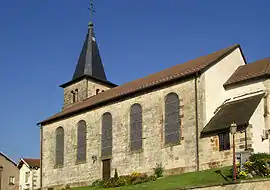 The church in La Chapelle-aux-Bois | |
.svg.png.webp) Coat of arms | |
Location of La Chapelle-aux-Bois | |
 La Chapelle-aux-Bois 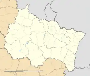 La Chapelle-aux-Bois | |
| Coordinates: 48°02′15″N 6°19′59″E / 48.0375°N 6.3331°E | |
| Country | France |
| Region | Grand Est |
| Department | Vosges |
| Arrondissement | Épinal |
| Canton | Le Val-d'Ajol |
| Intercommunality | CA Épinal |
| Government | |
| • Mayor (2020–2026) | Etienne Blaise[1] |
| Area 1 | 30.65 km2 (11.83 sq mi) |
| Population | 674 |
| • Density | 22/km2 (57/sq mi) |
| Time zone | UTC+01:00 (CET) |
| • Summer (DST) | UTC+02:00 (CEST) |
| INSEE/Postal code | 88088 /88240 |
| Elevation | 292–582 m (958–1,909 ft) (avg. 430 m or 1,410 ft) |
| 1 French Land Register data, which excludes lakes, ponds, glaciers > 1 km2 (0.386 sq mi or 247 acres) and river estuaries. | |
La Chapelle-aux-Bois (French pronunciation: [la ʃapɛl o bwa] ⓘ) is a commune in the Vosges department in Grand Est in northeastern France.
Geography
The Côney forms part of the commune's northwestern border.
See also
References
- ↑ "Répertoire national des élus: les maires". data.gouv.fr, Plateforme ouverte des données publiques françaises (in French). 9 August 2021.
- ↑ "Populations légales 2021". The National Institute of Statistics and Economic Studies. 28 December 2023.
Wikimedia Commons has media related to La Chapelle-aux-Bois.
This article is issued from Wikipedia. The text is licensed under Creative Commons - Attribution - Sharealike. Additional terms may apply for the media files.