 | |
|---|---|
| Route information | |
| Length | 120.7 km (75.0 mi) |
| Major junctions | |
| From | |
| To | |
| Location | |
| Country | Croatia |
| Counties | Požega-Slavonia, Osijek-Baranja |
| Major cities | Pakrac, Požega, Pleternica, Đakovo |
| Highway system | |
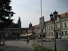
Đakovo, at the eastern terminus of the D38 road
D38 is a state road in the Slavonia region of Croatia that connects the cities of Pakrac, Požega, Pleternica and Đakovo.[maps 1] The road is 120.7 km (75.0 mi) long.[1]
The road, as well as all other state roads in Croatia, is managed and maintained by Hrvatske Ceste, state owned company.[2]
Traffic volume
Traffic is regularly counted and reported by Hrvatske Ceste, operator of the road.[3]
| D38 traffic volume | ||||
| Road | Counting site | AADT | ASDT | Notes |
| 3401 Pakrac east | 907 | 995 | Adjacent to the D5 junction. | |
| 3504 Pasikovci | 866 | 931 | Adjacent to the Ž4113 junction. | |
| 3505 Kuzmica | 5,111 | 5,145 | Adjacent to the Ž4116 junction. | |
| 3507 Pleternica east | 1,196 | 1,258 | Adjacent to the Ž4030 junction. | |
| 3605 Levanjska Varoš | 738 | 793 | Adjacent to the Ž4144 junction. | |
Road junctions
| D38 junctions | |
| Type | Slip roads/Notes |
| Pakrac Ž4099 to Šeovica. The western terminus of the road. | |
| Kusonje | |
| Dragović | |
| Španovica | |
| Bučje | |
| Glavica | |
| Mijači | |
| Kamenska | |
| Orljavac | |
| Kujnik | |
| Pasikovci Ž4113 to Milivojevci. | |
| Deževci | |
| Pavlovci | |
| Boričevci | |
| Vilić Selo | |
| Brestovac | |
| Nurkovac | |
| Završje | |
| Požega | |
| Vidovci | |
| Dervišaga | |
| Kuzmica Ž4116 to Jakšić and Vetovo. | |
| Srednje Selo | |
| Viškovci | |
| Blacko | |
| Vesela | |
| Pleternica Ž4030 to Kutjevo and Orahovica. | |
| Resnik | |
| Svilna | |
| Buk | |
| Kalinić | |
| Djedina Rijeka | |
| Ruševo | |
| Paka | |
| Slobodna Vlast | |
| Levanjska Varoš Ž4144 to Breznica Đakovačka. | |
| Ž4163 to Trnava and Staro Topolje. | |
| Ž4129 to Kondrić and Satnica Đakovačka (D515). | |
| Selci Đakovački | |
Ž4147 to Đakovo. Eastbound D38 traffic defaults to Ž4147 and vice versa. Southern terminus of the road. | |
Maps
- ↑ Overview map of the D38 (Map). OpenStreetMap. Retrieved August 19, 2014.
Sources
- ↑ Ministry of Sea, Transport and Infrastructure (Croatia) (May 10, 2013). "Odluka o razvrstavanju javnih cesta" [Decision on categorization of public roads]. Narodne novine (in Croatian) (066/2013).
- ↑ "Public Roads Act". Narodne novine (in Croatian). December 14, 2004.
- ↑ "Traffic counting on the roadways of Croatia in 2013 - digest" (PDF). Hrvatske Ceste. May 2014. Archived from the original (PDF) on 2014-07-29. Retrieved 2014-08-19.
See also
This article is issued from Wikipedia. The text is licensed under Creative Commons - Attribution - Sharealike. Additional terms may apply for the media files.