Charlestown, New Jersey | |
|---|---|
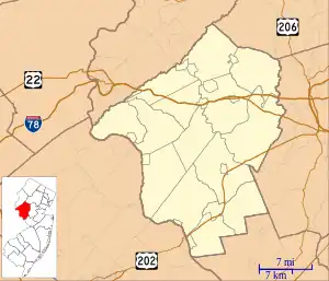 Charlestown, New Jersey Charlestown's location in Hunterdon County (Inset: Hunterdon County in New Jersey) 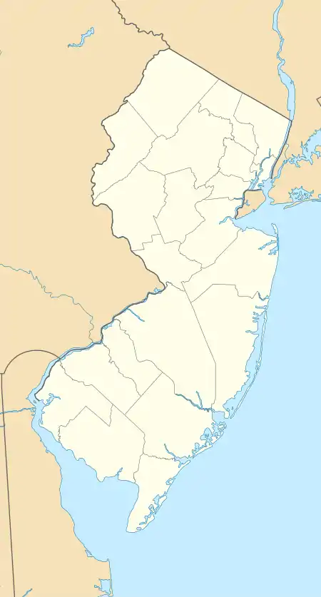 Charlestown, New Jersey Charlestown, New Jersey (New Jersey)  Charlestown, New Jersey Charlestown, New Jersey (the United States) | |
| Coordinates: 40°41′21″N 74°58′21″W / 40.68917°N 74.97250°W | |
| Country | |
| State | |
| County | Hunterdon |
| Township | Bethlehem |
| Elevation | 219 m (718 ft) |
| Time zone | UTC−05:00 (Eastern (EST)) |
| • Summer (DST) | UTC−04:00 (EDT) |
| GNIS feature ID | 875373[1] |
Charlestown is an unincorporated community located within Bethlehem Township, in Hunterdon County, in the U.S. state of New Jersey, off County Route 635, 1.5 miles (2.4 km) southwest of Hampton.[2][1][3]
History
By 1881, Charlestown had a school, wheelwright shop, blacksmith and about twelve dwellings.[4]
References
- 1 2 3 Feature Detail Report for: Charlestown, Geographic Names Information System. Accessed January 1, 2015.
- ↑ N 40.68917 W 74.97250, ACME Mapper. Accessed January 1, 2015.
- ↑ Locality Search, State of New Jersey. Accessed January 1, 2015.
- ↑ Snell, James P. (1881). History of Hunterdon and Somerset Counties, New Jersey. Everts & Peck. p. 462.
Municipalities and communities of Hunterdon County, New Jersey, United States | ||
|---|---|---|
| City |  Map of New Jersey highlighting Hunterdon County | |
| Boroughs | ||
| Town | ||
| Townships | ||
| CDPs | ||
| Other communities |
| |
| Footnotes | ‡This populated place also has portions in an adjacent county or counties | |
This article is issued from Wikipedia. The text is licensed under Creative Commons - Attribution - Sharealike. Additional terms may apply for the media files.