Železník | |
|---|---|
Municipality | |
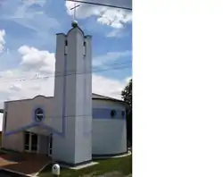 | |
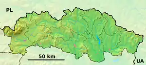 Železník Location of Železník in the Prešov Region 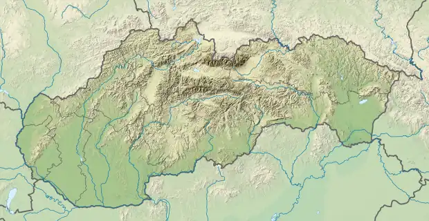 Železník Location of Železník in Slovakia | |
| Coordinates: 49°06′N 21°30′E / 49.100°N 21.500°E | |
| Country | |
| Region | Prešov |
| District | Svidník |
| First mentioned | 1382 |
| Area | |
| • Total | 5.97 km2 (2.31 sq mi) |
| Elevation | 180 m (590 ft) |
| Population | |
| • Total | 465 |
| • Density | 78/km2 (200/sq mi) |
| Time zone | UTC+1 (CET) |
| • Summer (DST) | UTC+2 (CEST) |
| Postal code | 087 01 (pošta Giraltovce) |
| Area code | +421-54 |
| Car plate | SK |
| Website | zeleznik |
Železník (Hungarian: Vaspataka) is a village and municipality in Svidník District in the Prešov Region of north-eastern Slovakia. The municipality lies at an altitude of 180 metres and covers an area of 5.97 square kilometres (2.31 square miles). It has a population of about 465 people. When it was under Hungarian rule it was called Vashegy, which literally means “Iron Hill”, and the mineral vashegyite is named after this village.[1][2][3]
History
In historical records the village was first mentioned in 1382.
References
- ↑ Merriam-Webster, the word "vashegyite".
- ↑ Mindat.org, the mineral "vashegyite".
- ↑ Mindat.org, the location Železník (Vashegy), Slovakia.
External links
 Media related to Železník at Wikimedia Commons
- Official website

- Stats
This article is issued from Wikipedia. The text is licensed under Creative Commons - Attribution - Sharealike. Additional terms may apply for the media files.