Černík | |
|---|---|
Municipality | |
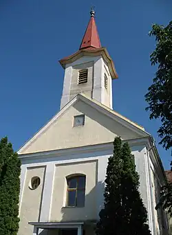 Church of the Holy Spirit | |
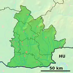 Černík Location of Černík in the Nitra Region 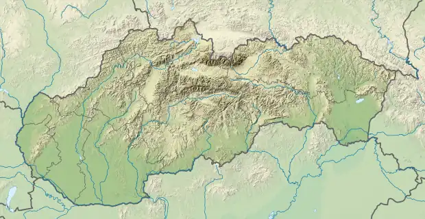 Černík Location of Černík in Slovakia | |
| Coordinates: 48°09′N 18°14′E / 48.150°N 18.233°E | |
| Country | |
| Region | Nitra |
| District | Nové Zámky |
| First mentioned | 1156 |
| Area | |
| • Total | 13.389 km2 (5.170 sq mi) |
| Elevation | 129 m (423 ft) |
| Population | |
| • Total | 990 |
| • Density | 74/km2 (190/sq mi) |
| Time zone | UTC+1 (CET) |
| • Summer (DST) | UTC+2 (CEST) |
| Postal code | 941 05 |
| Area code | 421-46 |
| Car plate | PD |
| Website | www.obeccernik.sk |
Černík (Hungarian: Csornok) is a village and municipality in the Nové Zámky District in the Nitra Region of south-west Slovakia.
History
The village was first mentioned in historical records in 1156.
Geography
The municipality lies at an altitude of 129 metres and covers an area of 13.389 km². It has a population of about 990 people.
Ethnicity
The population is about 99% Slovak.
Facilities
The village has a small public library a gym and football pitch.
Genealogical resources
The records for genealogical research are available at the state archive "Statny Archiv in Nitra, Slovakia"
- Roman Catholic church records (births/marriages/deaths): 1709-1918 (parish B)
- Lutheran church records (births/marriages/deaths): 1785-1896 (parish B)
See also
External links
 Media related to Černík at Wikimedia Commons
- Official website

- http://www.statistics.sk/mosmis/eng/run.html
- Surnames of living people in Cernik
- Černík – Nové Zámky okolie
This article is issued from Wikipedia. The text is licensed under Creative Commons - Attribution - Sharealike. Additional terms may apply for the media files.