Saint-Joseph-de-Coleraine | |
|---|---|
 | |
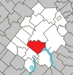 Location within Les Appalaches RCM | |
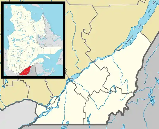 St-Joseph-de-Coleraine Location in province of Quebec | |
| Coordinates: 45°58′N 71°22′W / 45.97°N 71.37°W[1] | |
| Country | |
| Province | |
| Region | Chaudière-Appalaches |
| RCM | Les Appalaches |
| Constituted | November 11, 1891 |
| Government | |
| • Mayor | Ti Cail |
| • Federal riding | Mégantic—L'Érable |
| • Prov. riding | Lotbinière-Frontenac |
| Area | |
| • Total | 134.50 km2 (51.93 sq mi) |
| • Land | 126.87 km2 (48.98 sq mi) |
| Population | |
| • Total | 1,870 |
| • Density | 14.7/km2 (38/sq mi) |
| • Pop 2006-2011 | |
| • Dwellings | 1,171 |
| Time zone | UTC−5 (EST) |
| • Summer (DST) | UTC−4 (EDT) |
| Postal code(s) | |
| Area code(s) | 418 and 581 |
| Highways | |
| Website | www |
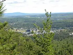
Saint-Joseph-de-Coleraine is a municipality in the Municipalité régionale de comté des Appalaches in Quebec, Canada. It is part of the Chaudière-Appalaches region and the population is 2,018 as of 2009. It is named after Saint Joseph, father of Jesus, and the town of Coleraine in County Londonderry, Northern Ireland.
References
- ↑ "Banque de noms de lieux du Québec: Reference number 56984". toponymie.gouv.qc.ca (in French). Commission de toponymie du Québec.
- 1 2 "Répertoire des municipalités: Geographic code 31045". www.mamh.gouv.qc.ca (in French). Ministère des Affaires municipales et de l'Habitation.
- 1 2 "Saint-Joseph-de-Coleraine (Code 2431045) Census Profile". 2011 census. Government of Canada - Statistics Canada.
External links
 Media related to Saint-Joseph-de-Coleraine at Wikimedia Commons
- Commission de toponymie du Québec
- Ministère des Affaires municipales, des Régions et de l'Occupation du territoire
Places adjacent to Saint-Joseph-de-Coleraine | ||||||||||||||||
|---|---|---|---|---|---|---|---|---|---|---|---|---|---|---|---|---|
| ||||||||||||||||
| Cities & Towns | |
|---|---|
| Municipalities | |
| Parishes | |
| |
This article is issued from Wikipedia. The text is licensed under Creative Commons - Attribution - Sharealike. Additional terms may apply for the media files.