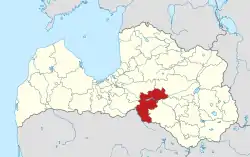
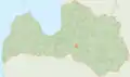
Aizkraukle Municipality
Aizkraukles novads | |
|---|---|
 Coat of arms | |
 | |
 | |
| Country | |
| Formed | 2001 |
| Reformed | 2021 |
| Centre | Aizkraukle |
| Government | |
| • Council Chair | Leons Līdums (VP) |
| Area | |
| • Total | 2,274.24 km2 (878.09 sq mi) |
| • Land | 2,196.74 km2 (848.17 sq mi) |
| Population (2023)[2] | |
| • Total | 28,950 |
| • Density | 13/km2 (33/sq mi) |
| Website | www |
Aizkraukle Municipality (Latvian: Aizkraukles novads) is a municipality in Vidzeme, Latvia. The municipality was formed in 2001 by merging town Aizkraukle and Aizkraukle Parish the administrative centre being Aizkraukle. The population in 2020 was 8,024.[3]
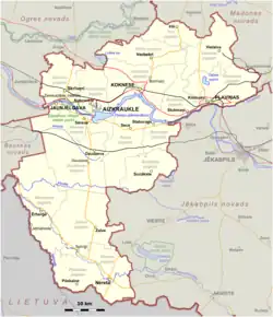
As a part of the 2021 Latvian administrative reform, the municipalities of Aizkraukle, Jaunjelgava, Koknese, Nereta, Pļaviņas and Skrīveri were merged into the new Aizkraukle Municipality. The new municipality encompasses nearly all of the area of the former Aizkraukle District, with the omission of Kurmene Parish and Valle Parish.
Subdivisions
- Aiviekste Parish
- Aizkraukle Parish
- Aizkraukle
- Bebri Parish
- Daudzese Parish
- Irši Parish
- Jaunjelgava Parish
- Jaunjelgava
- Klintaine Parish
- Koknese Parish
- Koknese
- Mazzalve Parish
- Nereta Parish
- Pilskalne Parish
- Pļaviņas
- Sece Parish
- Sērene Parish
- Skrīveri Parish
- Staburags Parish
- Sunākste Parish
- Vietalva Parish
- Zalve Parish
Twin towns – sister cities
Images
 Borders from 2001 to 2021
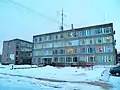 Aizkraukle Municipality Council building
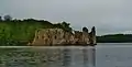
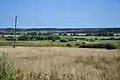 Landscape in Pilskalne Parish
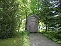 Monument to Jānis Jaunsudrabiņš in Nereta Parish
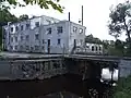
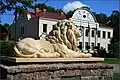 Jaunjelgava Parish administration building
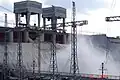
 Skrīveri Confectionary Plant, notable for its Gotiņa milk caramels
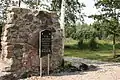 Potato Mutiny of 1841 memorial in Vecbebri
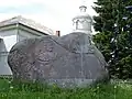 Monument to folklorist Gotthard Friedrich Stender at Sunākste Church
See also
References
- ↑ "Reģionu, novadu, pilsētu un pagastu kopējā un sauszemes platība gada sākumā". Central Statistical Bureau of Latvia. Retrieved 18 January 2023.
- ↑ "Iedzīvotāju skaits pēc tautības reģionos, pilsētās, novados, pagastos, apkaimēs un blīvi apdzīvotās teritorijās gada sākumā (pēc administratīvi teritoriālās reformas 2021. gadā) 2021 - 2022". Central Statistical Bureau of Latvia. Retrieved 3 October 2023.
- ↑ "ISG020. Population number and its change by statistical region, city, town, 21 development centres and county". Central Statistical Bureau of Latvia. 2020-01-01. Retrieved 2021-02-12.
- ↑ "Starptautiskā sadarbība". aizkraukle.lv (in Latvian). Aizkraukles novads. Retrieved 2020-03-30.
56°36′15″N 25°15′14″E / 56.60417°N 25.25389°E
This article is issued from Wikipedia. The text is licensed under Creative Commons - Attribution - Sharealike. Additional terms may apply for the media files.